Friday, March 27, 2009

Situ Gintung Dam Collapses in Tangerang, Banten

The 10-meter high Situ Gintung river dam collapsed on Friday, March 27, 2009 morning around 2 am and has inundated around 400 homes of which 250 were damaged or destroyed in Tangerang, Banten, near Jakarta. The police announced that a total of 100 people had been confirmed dead in the incident and 14 citizens of the district were reported missing (updated April 1, 2009).

Torrential rains Thursday raised the level of a reservoir behind the dam to almost 55 yards above capacity, apparently because the gate leading to the spillway was too small. The dam was overtopped, eroding the dam surface and resulting in a breach 70 metres (230 ft) wide at around 2 am on 27 March local time. Cracks were reportedly visible in the face of the dam embankment from around midnight. The dam operators apparently sounded a warning siren shortly before the dam failed. A surge of water and debris several meters high was sent into the town of Cirendeu, washing away cars, houses and a brick-built bridge.The flood hit while most of the population was asleep and left standing water up to 2.5 meters (8.2 ft) deep. Many people remain trapped in the town with around half of the townspeople taking to their rooftops to avoid the floodwater. The flood also submerged five power terminals cutting drinking water supplies to the nearby suburb of Lebak Bulus.

Emergency repairs to the dam structure are already underway and the government has begun inspections of similar dam structures.


Image sources : BBC news

Tuesday, March 10, 2009

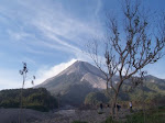
Indonesian government raises alert on Semeru volcano in East Java

The Indonesian Volcanology Center has raised a maximum alert on the Mount Semeru volcano in East Java, warning of potentially dangerous lava flows.

The 3,676-metre (12,060-ft) Semeru is one of the most active volcanoes on Java Island. Geographically, it’s located at the position of 8° 06’ 30’’ Latitude and 112° 55’ Longitude. Its highest point is called Mahameru (+ 3676 meter) which is the highest peak on Java. Seven people were killed by the mountain's heat clouds in 1994.

The alert status was raised on the afternoon of Friday, March 6, 2009, following a number of volcanic quakes indicating that there might be a larger eruption. The authority said that at the moment it was not necessary to evacuate residents around the mountain, but warned those carrying out activities such as sand mining to avoid rivers because of lava flows and forbade climbers to access the area within 4 km of the peak. Indonesians often live and work on the slopes of volcanoes because of the rich volcanic soil and supplies of minerals.

Based on satellite images, volcanic activity so far would not disturb air traffic. The nearest major city to Semeru is Surabaya. The area is also popular with hikers and nearby Mount Bromo is a well known tourist site.

Saturday, March 7, 2009

Review of "The Yogyakarta Earthquake of May 27, 2006” Book

• Hardcover: 288 pages
• Publisher: Star Pub Co; 1st edition (January 31, 2008)
• Language: English
• ISBN-10: 0898633044
• ISBN-13: 978-0898633047

The book is comprised of twenty-five international scientific papers about the Yogyakarta earthquake. It includes information on the geologic and seismological structure of the Yogyakarta Special Province and the Central Java Province and the effects of the 2006 earthquake on the local communities.

The Mw 6.3 earthquake of May 27, 2006, which occurred near the City of Yogyakarta, Indonesia, was the largest in the region over the last 60 years. Although this was a moderate earthquake, it resulted in severe consequences: 5,700 fatalities, 37,000 injuries, the destruction or heavy damage to over 300,000 buildings and economic losses of approximately 28 trillion rupiahs (approximately 3.1 billion US dollars). The purpose of this volume is to memorialize conditions in Yogyakarta, especially the Bantul area, at the time of the earthquake, the effects and consequences of the earthquake, as well as to present some of the lessons learned in order to enhance hazard preparedness, mitigation and response. Work on the volume began three months after the earthquake and was completed within one year.

The volume consists of three parts which focus on issues related to the geology and seismology of Yogyakarta in Central Java; the impact of the earthquake on buildings, schools, and temples and suggestions for earthquake-resistant construction. Social issues, health care, and policies for the enhancement of disaster management are also treated.

The contributing authors are world experts in geology, seismology, hazard mitigation, emergency response and related topics. Construction policies and standards, social policies, governmental emergency procedures and management issues, dealing with local customs are among the issues and topics discussed and explained by experts from Indonesia, Japan, Russia, Germany, England and the USA.

You can obtain the book here.

Tuesday, March 3, 2009

Landslide Prone areas, March 2009

Landslide prone areas in March 2009, in all provinces of Indonesia. Presented both as maps and tables by the Indonesian Government. You can find it here.

Sunday, February 22, 2009

About the website

This website was built in response to the limited sources of information available in English concerning natural disasters in Indonesia. It is meant to provide information understandable to the broad international community, especially those interested in disaster response.

The website hosted by an Indonesian geologist. The publisher wishes to thank the Visualization Center of San Diego State University for its contribution to this effort.

This website consists mainly of current information about disasters occurring in Indonesia, especially related to geological conditions. It also contains analyses of these events and information on important meetings, conferences and workshops on Indonesian disasters and natural hazards. There are also links to other sources of information and other publications related to these subjects.

Hopefully, this website can become a source of basic information for those interested in disaster response in Indonesia and for those interested in conducting research in these topics. Hopefully it will prove of value to Indonesian disaster recovery.

Sunday, February 15, 2009

Sangihe-Talaud 7.2 Mw Earthquake, February 12, 2009

A moment magnitude 7.2 Mw was happen in Kepulauan Talaud, Indonesia on February 12, 2009, local time 01.34, resulting 2 fatalities, 10 heavy injured while other 42 people wounded and over 700 building collapse. More than 5000 citizen were evacuated to avoid the affect of continuous aftershock in magnitude 4 Mw to 6 Mw that are still happening in the region.

This earthquake likely occurred as a result of reverse faulting on or near the plate-boundary system separating the Philippine Sea and Celebes Sea basins. Northeastern Indonesia is characterized by complex tectonics in which motions of numerous small plates are accommodating large-scale convergence between the Philippine Sea and Sunda plates. In the region of today's earthquake, the Philippine Sea plate moves west-northwest with respect to the Sunda plate at a velocity of about 62 mm/year. Locally, arc-arc collision is occurring between the Sangihe and Halmahera micro plates, wedging between them the Molucca Sea micro plate, which subducts beneath both (i.e. to the east and west) and forms an inverted-U-shaped seismic zone. Seismicity within the Molucca Sea plate is active to depths of approximately 260 km to the east and 400 km to the west. The tectonic setting of this region is unique in that it is the only global example of an active arc-arc collision consuming an oceanic basin via subduction in two directions and it drive the area to become one of the most tectonic-active in the world today.


The earthquake occurred approximately 30 km off the western coast of the Pulau Salebabu (Indonesia) in an area that has seen large earthquakes in the past. Since 1986, there have been two earthquakes with magnitude greater than 7 in this region.

USGS data showed that the epicenter located in 3.902 deg N, 126.400 deg E with depth 20 km with magnitude 7.2 Mw. Global CMT Moment Tensor Solution shows that this earthquake caused by thrust faulting with direction of 181 deg NE and dip 37 deg. This earthquake supposed to be potentially trigger tsunami, but it was reported that no tsunami occurred.

The earthquake summary poster from USGS