Indonesia is located in southeast Asia; it is a huge archipelago extending 5,120 kilometers from east to west and 1,760 kilometers from north to south along the equator. It is comprised of 13,667 islands (some sources say as many as 18,000), with only 6,000 of which are inhabited. There are five main islands (Sumatra, Java, Kalimantan, Sulawesi, and Irian Jaya), two major archipelagos (Nusa Tenggara and the Maluku Islands), and sixty smaller archipelagos. Two of the islands are shared with other nations; Kalimantan (known in the colonial period as Borneo, the world's third largest island) is shared with Malaysia and Brunei, and Irian Jaya shares the island of New Guinea with Papua New Guinea. Indonesia's total land area is 1,919,317 square kilometers and it has a total population of 223,042,000 (as of 2006). Included in Indonesia's total territory is another 93,000 square kilometers of inland seas (straits, bays, and other bodies of water). The additional surrounding sea areas bring Indonesia's generally recognized territory (land and sea) to about 5 million square kilometers. The government, however, also claims an exclusive economic zone, which brings the total to about 7.9 million square kilometers.

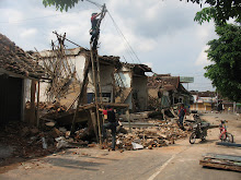
The tectonics of Indonesia are very complex, as it is a meeting point of two tectonic plates, Indo-Australia and Eurasia. The Indo-Australian plate was moved northward and subducted under the Eurasian plate. The subduction zone can be traced from the northern tip of Sumatra to the Lesser Islands and creates a deep submarine trench. Most of the earthquakes are concentrated in this subduction zone. In December 2004, a 9.1 magnitude underwater earthquake caused a devastating tsunami, resulting in over 120.000 deaths in Aceh Province. In May 2006, a 6.2 earthquake struck Yogyakarta province resulting in over 5700 fatalities and over 37,000 injuries. This subduction has also triggered the formation of volcanic ranges that run along Sumatra and Java to the Lesser Islands. Eastern Indonesia is also affected by another subduction area of the Pacific Plate that moves southwesterly under the Eurasian Plate. This subduction creates the formation of volcanoes in the North Sulawesi, Sangihe and Halmahera islands.
The tectonic processes in Indonesia formed major structures. The most prominent fault in western Indonesia is the Semangko Fault, a dextral strike-slip fault along Sumatra Island. The formation of this fault zone is related to the subduction zone in the west of Sumatra. Palu-Koro fault is another major structural feature formed in the central part of Indonesia. This fault has similar orientation as the Semangko fault and extends from Koro in the central part of Sulawesi, to Palu on the west coast of Sulawesi and across the Makassar Strait to East Kalimantan.
These tectonic conditions also created numerous mountains and some 400 volcanoes, of which approximately 100 are active. Between 1972 and 1991 alone, twenty-nine volcanic eruptions were recorded, mostly on Java. The most violent volcanic eruption in modern times occurred in 1815 at Gunung Tambora on the north coast of Sumbawa in Nusa Tenggara Barat Province, claimed 92,000 lives and created "the year without a summer" in various parts of the world. In 1883 Krakatau in the Sunda Strait, between Java and Sumatra, erupted and some 36,000 West Javans died from the resulting tidal wave. The sound of the explosion was reported as far away as Turkey and Japan. For almost a century following that eruption, Krakatau was quiet, until the late 1970s, when it erupted twice.
In terms of economic geology, about 60 Tertiary sedimentary basins, spread out from Sumatra in the west to Irian Jaya in the east, are identified in Indonesia. So far only 38 basins have been explored and drilled for petroleum and 14 of them are now producing oil and gas. Seventy-three percent of these basins are located offshore, about one third of them in the deeper sea, with water depths exceeding 200 m.

Straddling the equator, Indonesia has a tropical climate characterized by heavy rainfall, high humidity, high temperatures, and low winds. Rainfall in lowland areas averages 180–320 cm (70–125 in) annually, increasing with elevation to an average of 610 cm (240 in) in some mountain areas. In the lowlands of Sumatra and Kalimantan, the rainfall range is 305–370 cm (120–145 in). Average humidity is 82%.
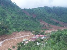
Due to its geological and climatic conditions, Indonesia is prone to geohazards such as earthquakes, volcanic eruptions, landslides, forest fires and floods.


