Thursday, October 1, 2009

Post disaster satellite imagery of Padang earthquake

These imagery provided by The "Center for Satellite Based Crisis Information" (ZKI). ZKI is a service of DLR's German Remote Sensing Data Center (DFD). Its function is the rapid acquisition, processing and analysis of satellite data and the provision of satellite-based information products on natural and environmental disasters, for humanitarian relief activities, as well as in the context of civil security. The analyses are tailored to meet the specific requirements of national and international political bodies as well as humanitarian relief organizations.

This posting is purely intend to provide information needed for the Padang earthquake relief, copyright of the imagery are belongs to The "Center for Satellite Based Crisis Information" (ZKI)

Potential Building Damage: Map of Padang, Indonesia, 1:20.000
(follow this link)

Population Map of Padang, Indonesia, Southern Part, with building damages as of October 1, 2009, 1:15.000
(follow this link)

Population Map of Padang, Indonesia, Northern part, with building damages as of October 1, 2009, 1:15.000
(follow this link)

Situation Map of Padang, Indonesia, Northern part, with building damages as of October 1, 2009, 1:15.000
(follow this link)

Situation Map of Padang, Indonesia, Southern Part, with building damages as of October 1, 2009, 1:15.000
(Follow this link)

Wednesday, September 30, 2009

Magnitude 6.6 South Sumatra Earthquake following September 30, West Sumatra earthquake

Magnitude 6.6 struck South Sumatra region on Thursday, October 01, 2009 at 08:52:29 AM local time. The epicenter located 270 km southeast of the damaging M 7.6 earthquake of September 30, 2009 offshore Padang at position 2.589°S, 101.546°E. It is not clear at present if these events are related but there is a big possibility that the Padang earthquake triggering the October 1st earthquake. Hundreds buildings collapse while fatalities are not reported yet but expected to rise.

According to USGS, the October 1st, 2009 Mw6.6 earthquake in southern Sumatra occurred as a result of shallow strike-slip faulting within the Sunda Plate. In the epicentral region of this earthquake, the Australian plate moves northwestwards with respect to the Sunda Plate at a rate of approximately 65 mm/yr. Oblique convergence at the trench, to the west of this earthquake, is partitioned between thrust motion on the subduction zone interface and strike-slip motion in the upper plate, near the Sumatra Fault. Todays earthquake is likely related to the latter strike-slip component of this motion, accommodating the northward motion of the Sunda block with respect to the interior of the Eurasian Plate. On the basis of the currently available fault mechanism information and a depth of 15 km, it is likely that this earthquake occurred along the Sumatran Fault or on a closely related structure. The recent earthquake is consistent with NW-directed, right-lateral displacement along the Sumatran Fault system.

Links:
Intensity Map

Magnitude 7.6 earthquake hits Padang, West Sumatra

A powerful earthquake rocked western Indonesia Wednesday, trapping thousands under collapsed buildings — including two hospitals — and triggering landslides. At least 75 people were killed; the death toll was expected to rise. (Update: The official release on October2, a total of 1100 people were confirmed dead and 421 seriously injured, these numbers are still expected to rise along with the search and rescue progress.)

The magnitude 7.6 quake struck at 5:15 p.m. local time (1015GMT, 6:15 a.m. EDT), just off the coast of Padang city at position 0.789°S, 99.961°E. A tsunami warning for countries along the Indian Ocean was issued, and panicked residents fled to higher ground fearing giant waves. The warning was lifted about an hour later.

Initial reports received by the government said 75 people were killed, but the real number is expected to rise shortly.

The quake triggered landslides that cut all roads to Padang. Power and telecommunications were also cut. Fire also broke out in buildings on a road to the city, officials said.

Links:
The intensity Map
Moment tensor solution
Population exposure


Figure:
A man stands in front of a collapsed building after an earthquake hit Padang, on Indonesia's Sumatra island September 30, 2009 (Reuters)

Wednesday, September 2, 2009

A magnitude 7.0 Earthquake Strikes West Java

A magnitude of 7.0 earthquake killed at least 32 people and forced thousands to evacuate on Indonesia's main island of Java on Wednesday, September 02, 2009 at 02:55:01 PM local time. The death toll was expected to rise . Over 3,586 homes were damaged. The epicenter of the quake was 195km south of Jakarta and 95km south of Bandung city in the position of 7.778°S, 107.328°E with the uncertainty of horizontal +/- 6.6 km (4.1 miles); depth +/- 12.3 km (7.6 miles).

The 7.0 magnitude quake, as recorded by the U.S. Geological Survey, shook buildings in the capital Jakarta and flattened homes in villages closer to the epicenter in West Java. The quake was felt over roughly half of Java Island. In the capital, Jakarta, 120 miles (190 kilometers) from the epicenter, office workers ran onto the streets. A tsunami warning was issued after the quake struck, but revoked an hour later.

The worst report of fatalities was from a village in Cianjur district, where about 30 people were still believed trapped under rocks and dirt after a landslide triggered by the tremor buried their homes.

Update: on Thursday (September3, 2009 afternoon) the government report that the total casualties in the entire West Java Province reaches the number of 54, 147 peoples wounded and 10.000 evacuated. The construction damaged includes 34 homes totally destroyed, 11.000 heavily destroyed and light damage on 15.000 houses.

Monday, August 3, 2009

A video: Life in the shadow of Indonesia's volcanoes - 01 July 2008

In Indonesia, many people live close to active and dangerous volcanoes. On Java island alone, around 120 million people live in the shadows of more than 30 volcanoes.

Al Jazeera's David Hawkins reports.


Monday, July 6, 2009

5.9-magnitude earthquake hits North Sulawesi

A magnitude of 5.9 jolted North Sulawesi on Thursday, July 02, 2009 at 05:10:45 AM local time. There was no immediate report of casualties or material damage. The epicenter was located at a depth of 23 kilometers below sea level, 107 kilometers southeast of Bitung, which lies 50 kilometers to the east of North Sulawesi's capital Manado.

Local meteorology and geophysics agency (BMG) said that the quake did not have the potential to cause a tsunami and its magnitude was felt by people in Bitung, Minahasa, Minahasa Selatan, Manado as well as the islands of Sangihe and Talaud.

Previously, at 06:59 a.m. Friday, June 5, 2009, at the same area, a magnitude 5 earthquake occurred, no damage was reported. On Tuesday, June 30, a magnitude 3.0 occurred at the Kendari gulf, 15 kilometers from Kendari, Southeast Sulawesi.

Thursday, June 4, 2009

Maximum alert on Karangetang volcano, Sulawesi

Indonesian Geological Agency has raised the alert level for Karangateng volcano on May 31, 2009 into its maximum level. It began spewing hot clouds and lava, and volcanic tremor on May 30, 2009. Hundreds of people were evacuated from near the volcano. Total number of vulnerable population approximately 3,000 people.

Karangetang Volcano is located in central Sangihe Islands, lies at the northern end of the island of Siau, north of Sulawesi Indonesia. It is a stratovolcano rising 1784 m above sea level and 2700 m above the ocean floor. The summit contains five nested craters aligned in a north-south direction, the largest of which is 350 m in diameter. More than 40 eruptions recorded since 1675 and many additional small eruptions that were not documented in the historical record (Catalog of Active Volcanoes of the World: Neumann van Padang, 1951). The last deadly eruption of Karangetang occurred in 1992, which killed at least six villagers. Twentieth-century eruptions have included frequent explosive activity sometimes accompanied by pyroclastic flows and lahars.

(Photo caption: Karangetang volcano, 2008, Photo by Meiyer Damima)

Table : Color code-alert level for volcanic hazard in Indonesia (Geological Agency of Indonesia)


Location of Karangetang volcano at Sangihe islands, north of Sulawesi main island
(in repair)

Zoom in satellite image of Karangetang volcano at Siau island
(in repair)

Karangetang volcano at Siau island, photo by Marc Tolosa, 2007

Friday, May 29, 2009

Human role in Indonesian polluting forest fires

By: Netherlands Organization for Scientific Research

The large forest fires that sweep through Indonesia in dry periods are not only the result of severe drought. A team of researchers, including Veni grant winner Guido van der Werf, has analysed the density of smog during forest fires. They have now established that the intensity of the forest fires is directly linked to population density and land use. Nature Geoscience published the results of the research on 22 February.

The biggest problem of the fires in Indonesia is not the fire itself but the poisonous smoke released. Due to this smoke, the number of people killed by fires in Indonesia is probably many times higher than that in Australia this year. Furthermore, the smog also causes severe damage to the environment. Knowledge about the causes of these fires is essential for improved predictions of major fire years.

Where there's smoke...


The researchers used the thick smoke produced by the Indonesian fires to analyse the forest fires. Due to a lack of good satellite images, little is known about fires that took place before the 1990s. The researchers solved this problem by using other data recorded daily during the past fifty years, namely the visibility observations and meteorological data from airports.

One of the most interesting results from the study was that low rainfall in Sumatra has been resulting in fires since at least 1960, while in Kalimantan this has only been the case since 1980. Kalimantan was fairly resistant to dry periods up until 1980, but since then Kalimantan has become far more prone to fires prone during drought years. The population of Sumatra grew rapidly in the 1960s. However, a comparable increase in the population was not seen in Kalimantan until the 1980s.

The rising population on Kalimantan was accompanied by a change in land use from small-scale subsistence agriculture to large-scale industrial agriculture and agroforestry. In order to support this change, large areas of peatlands were drained and deforestation took place on a grand scale. These changes in land use and population density made Kalimantan far more fire prone. Although the enormous influence of this man-made change was already suspected, this is the first time that these claims have been substantiated by reliable data.

Climate change

In addition to the major human influences, the researchers also analysed the influence of two meteorological phenomena. The influence of El Nino on the amount of rainfall was already known, but the Indian Ocean Dipole, that exerts a major influence on the water surface temperature, appeared to be an equally important factor.

Although severe drought provides the conditions conducive for forest fires, it is often humans who are actually responsible. Many of the fires are deliberately started to free up land for agriculture. The sustained burning of biomass not only releases the greenhouse gases carbon dioxide and methane but also large quantities of carbon monoxide and particulate matter. Consequently, during major fire years the air quality in Indonesia is many times worse than that of the most polluted cities of the world. Moreover, the polluted air also affects people living in neighbouring areas.

Researcher Guido van der Werf from the VU University Amsterdam carried out his research in collaboration with Robert Field and Samuel Shen. In 2008, Van der Werf was awarded NWO's prestigious Vening Meinesz prize for the most promising young researcher in the earth sciences.

Source: YubaNet.com

Forest Fires in Sumatra

Up to Friday, May 29, 2009, sixty three hot spot were identified in Sumatra island. Most of them were occurred in Riau, Bengkulu, South Sumatra and Jambi province. The authority said that the number had been decreasing, two days before they identify as much as 350 hot spot. The smoke reduce the viewing distance, but haven't reach the limit to affect air traffic.

The islands of Sumatra and Borneo have been repeatedly affected by forest fires. As it happened in 1997 and 2004 when forest fires on Indonesian islands disrupted flights at the Sumatran city of Pekanbaru and blanketed neighboring Singapore and Malaysia with smog for months.

Some of the fires are caused by lightning strikes, but many have been blamed local farmer and plantation firm practice burning off of farm land and forest clearance. Despite a government ban on burning forests for land, the practice has continued unabated.

Picture : An aerial view of a forest fire in Dumai in Indonesia's Riau province February 26, 2008 (Source : Daylife)

Sunday, May 10, 2009

Preparing for the Worst, Hoping for the Best

by: Titania Veda (the Jakarta Globe)

After the tsunami hit Aceh, Padang and the rest of West Sumatra were left unscathed, but the news induced great trauma in the people,” said Patra Rina Dewi, executive director of the Tsunami Alert Community (Kogami), a local nongovernmental organization.

The Dec. 26, 2004, Indian Ocean tsunami was the worst the world had seen in around 600 years, and Padang’s neighbor, Aceh, lost 170,000 people to the waves, making it the worst-hit area in the world. Just four months later, a 6.7-magnitude earthquake hit Padang, sending thousands of residents fleeing inland in fear of another tsunami. “Our first priority became to assuage the fears of the people,” Patra said. “They were scared because there was no information about when they had to run or what action they should take.”

Established in July 2005, Kogami has been working to instill a culture of disaster preparedness among Padang’s residents. Training people is a key component of its efforts. To achieve its aim — to reduce risks by strengthening capacity and decreasing vulnerability — Kogami has set up a number of programs, including educational programs for school students, educational material development, capacity building, disaster mitigation and surveys and assessments.

The organization includes 12 permanent staff members, 200 facilitators, who are all local volunteers, and an international team of geologists from Indonesia, Japan, Germany and the United States. “At the beginning, our knowledge about disasters was zero,” Patra said. “None of us had a background in disaster training. We came from engineering, farming and agricultural backgrounds.”

A San Francisco-based NGO called the SurfZone Relief Operation, which was already providing aid to Sumatra, wanted to set up an educational program for disaster preparedness. The local volunteers involved with SurfZone established Kogami.

Kogami chose to focus on Padang when it launched because the city has the largest population of people at risk of a major tsunami. Out of Padang’s 750,000 residents, 400,000 live or work by the sea, Patra said. Other areas surrounding the city that are under threat are the West Sumatra districts of Pesisir Selatan, Agam, West Pasaman, Padang Pariaman, the city of Pariaman and the Mentawai Islands. This year, Kogami has begun work with the people of Pesisir Selatan and Padang Pariaman, with support from the Mercy Corps.

At first, the organization had a difficult time connecting with the local community and government. “They weren’t ready to hear the word tsunami,” Patra said. “The government said we were preventing investors and tourists from coming here.” But Patra said doing nothing about the situation would in fact turn investors away.

Since 2005, a total of 61 schools have received trained for dealing with natural disasters. Starting from the first grade, children are taught how to prepare for earthquakes and tsunamis and what to do should they hit the region. “They have to know where it is safe to place the teacher’s desk, if it’s safe to place desks next to windows. They have to present a plan to the class,” Patra said.

In January 2009, a trial program to integrate disaster preparation into the curriculum began in 12 Padang schools. Education workshops are also held in villages to ensure a system is in place and that everyone has the necessary knowledge of disaster planning and evacuation strategies. Among their various activities, Kogami has mapped out evacuation routes. High-risk areas are zoned red, while low-risk areas are zoned yellow. “People can identify which the closest evacuation route is for them based on sector maps of the city,” Patra said.

Kogami has installed a preventive-measures group in each threat zone. The groups are made up of locals, who focus on disaster and emergency preparation in the red zones and the establishment of “3x24” emergency shelters in yellow zones. “We predict that help won’t come for times 24 hours and that local resources will have to be able to shelter casualties for that amount of time,” Patra said. Religious beliefs are often a challenge to Kogami. Patra said the local mind-set was often, “If Allah thinks we’re meant to die, we shall die.” Kogami is attempting to change this perception. “We need to break down this mentality because we need to try our best first, and then leave it to God.”

Note: a re-post from an article publish in the Jakarta Globe on May10, 2009
Image source: the Jakarta Globe
Thursday, April 23, 2009

Indonesian government raises alert on Slamet volcano in Central Java

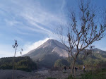
The Indonesian Volcanology Center has raised the alert from level II to Level III on Slamet Mountain in Central Java. The Center has set four levels increasing intensity of volcanic activity with level I for the lowest and level IV for the highest. The 3,432-metre Slamet Mountain strato volcano is the second highest volcano in Java after Mount Semeru. It began to spew lava on Wednesday (22nd April 2009) after rising volcanic activity was recorded for over a month. Geographically, it’s located at the position of 7° 14’ 30’’ Latitude and 109° 12’30” Longitude. The closest cities are Purwokerto, Purbalingga and Tegal.

The alert status was raised on the afternoon of Thursday, April 23, 2009, following a number of volcanic quakes, rising hydrothermal temperature, and at least 52 small explosions, indicating the potential for a larger eruption. The Center said that at the moment it was not necessary to evacuate residents around the mountain, but asked the residents to keep alert and be prepared for the possibility of ash fall that may cause upper respiratory tract infections if inhaled. The summit area is closed to any activity.

Update: on May 26, 2009 Indonesian Volcanology Center still maintain Slamet Mt on alert level III, based on deformation data, intensive volcanic tremor, lava, ash and gas explotion.

on June 29, 2009 Indonesian Volcanology Center lower the alert level to level II

Slamet Mt crater (Rob Woodall photography)

Monday, April 13, 2009

Download

Full papers in PDF format:

Monday, April 6, 2009

Indonesian Scientists Develop a Community-based Landslide Early Warning System

Landslides form some of the worst disasters in Indonesia. Over the past seven years, more than 36 landslides occurred resulting in the deaths or disappearance of 1226 people and millions of US dollars in losses.

Most areas susceptible to landslides are densely populated, due to the presence of fertile soil and good water resources which often contribute to slope instability. Despite efforts to establish slope protection zones by restricting development and settlement, efforts to carry out a relocation program have been difficult due to socio-economic constraints. Thus, a landslide early warning system is urgently needed to guarantee the safety of communities in such areas.

Dr. Dwikorita Karnawati from the Geological Engineering Department of the Gadjah Mada University-Indonesia (GED-GMU) led the team seeking to install early warning systems in several pilot areas, including Banjarnegara Regency and Karanganyar Regency in Central Java, as well as Situbondo Regency East Java. The teams were multi-disciplinary, with experts such as geologists from GED-GMU (Mr. Ign. Sudarno and Mr. Fajar Tri Prasetya), a civil engineer from GMU (Dr. Teuku Faisal Fathani), A GMU sociologist (Mr. Suharto), accompanied by Dr. Paul Burton from East Anglia University-UK and several local people.

To be effective, a landslide early warning system should be inexpensive, simple to operate and installed in the most appropriate sites. Therefore such systems must be based on the incorporation of sound technological and sociological approaches.

Most of the landslides occurring in the susceptible areas are debris slides which usually are initiated by extension cracks. Thus, the extensometer is considered the most appropriate monitoring and warning equipment, which should be placed by using extension wires across the extension cracks.

To guarantee such a comprehensive monitoring system, five sets of manual extensometers which cover the area of about 75 to 100 hectares were installed in the selected sites. Those extensometers were designed to stretch automatically across the cracks in response to the enlargement of the cracks caused by slope movement. The crack-extension is the indicator of the slope movement that proceeds a landslide. Accordingly, when the extensometer's string is stretched up to 4 cm in length (this length was defined based on previous empirical investigations at similar susceptible landslide areas), the connected alarm sounds an early warning to the community, allowing time for escape.

One extensometer was designed not only to monitor the lateral movement at the slope surface, but also the vertical deformation, as well as the rotational direction of the sliding. Thus, within one extensometer, three different directions of movement can be monitored by utilizing simple but low cost materials.

All of the monitoring system was connected with the siren alarm, which can be heard by the community up to a distance of 500 m. The first community group hearing the alarm then should hit the ‘thong-thong’ (local warning system made from wood or bamboo) to transfer the warning to the other community groups living in the distance beyond 500 m. This five extensometer installment needs to be incorporated with one rain gauge. The rain gauge was installed in the top of the slope to record the rainfall, because landslides in the area mostly occurr as the result of rain. The alarm was also set to start if the accumulative rain infiltration reaches 100 mm. This critical amount of rain infiltration was set based on previous research conducted by Karnawati (1996) and Su Su Ky (2007).

Because of the simplicity of its design, the equipment can be constructed in local home workshops. Thus, the three-directional extensometer will not only potentially reduce landslide risk to human life, but also stimulate the local economy.

Schematic performance of extensometer installed across the crack (Japan Landslide Society, 1996).

Rain gauge developed by T.F. Fathani & D.Karnawati,Gadjah Mada University, 2007 (Paten No. P00200800299). Extensometer developed by T.F. Fathani & D.Karnawati, Gadjah Mada University, 2007 (Paten No. P0020080030).

Evacuation drill at Kalitelaga Village, Banjarnegara District, Central Java Province, conducted on September 2007.

The Faculty of Engineering, Gadjah Mada University and the Indonesian Ministry of Development for Disadvantaged Regions reported that the early warning system equipment has worked properly in Kalitelaga District, at Banjarnegara Regency, Central Java. In November 2008, the extensometer alarm came on following the early warning issued by the rain gauge, giving the community enough time to move to safer ground. Several houses were damaged in the landslide and the access road to the village was buried. Fortunately, 35 families living were saved.

The challenge is to implement this early warning system (EWS) in areas where no landslide has yet occurred. Some resistance from the community, especially relating to setting aside land for the equipment, may be the most difficult problem to tackle. Encouraging the community to maintain the operation of the equipment is another challenge.

The government of Indonesia is considering other pilot EWS programs in Java and Sumatra.

Data courtesy of: Karnawati, et al, based on the Proceedings of the first World Landslide Forum, Tokyo , November 2008, pp. 305 - 308.

Friday, March 27, 2009

Situ Gintung Dam Collapses in Tangerang, Banten

The 10-meter high Situ Gintung river dam collapsed on Friday, March 27, 2009 morning around 2 am and has inundated around 400 homes of which 250 were damaged or destroyed in Tangerang, Banten, near Jakarta. The police announced that a total of 100 people had been confirmed dead in the incident and 14 citizens of the district were reported missing (updated April 1, 2009).

Torrential rains Thursday raised the level of a reservoir behind the dam to almost 55 yards above capacity, apparently because the gate leading to the spillway was too small. The dam was overtopped, eroding the dam surface and resulting in a breach 70 metres (230 ft) wide at around 2 am on 27 March local time. Cracks were reportedly visible in the face of the dam embankment from around midnight. The dam operators apparently sounded a warning siren shortly before the dam failed. A surge of water and debris several meters high was sent into the town of Cirendeu, washing away cars, houses and a brick-built bridge.The flood hit while most of the population was asleep and left standing water up to 2.5 meters (8.2 ft) deep. Many people remain trapped in the town with around half of the townspeople taking to their rooftops to avoid the floodwater. The flood also submerged five power terminals cutting drinking water supplies to the nearby suburb of Lebak Bulus.

Emergency repairs to the dam structure are already underway and the government has begun inspections of similar dam structures.


Image sources : BBC news

Tuesday, March 10, 2009

Indonesian government raises alert on Semeru volcano in East Java

The Indonesian Volcanology Center has raised a maximum alert on the Mount Semeru volcano in East Java, warning of potentially dangerous lava flows.

The 3,676-metre (12,060-ft) Semeru is one of the most active volcanoes on Java Island. Geographically, it’s located at the position of 8° 06’ 30’’ Latitude and 112° 55’ Longitude. Its highest point is called Mahameru (+ 3676 meter) which is the highest peak on Java. Seven people were killed by the mountain's heat clouds in 1994.

The alert status was raised on the afternoon of Friday, March 6, 2009, following a number of volcanic quakes indicating that there might be a larger eruption. The authority said that at the moment it was not necessary to evacuate residents around the mountain, but warned those carrying out activities such as sand mining to avoid rivers because of lava flows and forbade climbers to access the area within 4 km of the peak. Indonesians often live and work on the slopes of volcanoes because of the rich volcanic soil and supplies of minerals.

Based on satellite images, volcanic activity so far would not disturb air traffic. The nearest major city to Semeru is Surabaya. The area is also popular with hikers and nearby Mount Bromo is a well known tourist site.

Saturday, March 7, 2009

Review of "The Yogyakarta Earthquake of May 27, 2006” Book

• Hardcover: 288 pages
• Publisher: Star Pub Co; 1st edition (January 31, 2008)
• Language: English
• ISBN-10: 0898633044
• ISBN-13: 978-0898633047

The book is comprised of twenty-five international scientific papers about the Yogyakarta earthquake. It includes information on the geologic and seismological structure of the Yogyakarta Special Province and the Central Java Province and the effects of the 2006 earthquake on the local communities.

The Mw 6.3 earthquake of May 27, 2006, which occurred near the City of Yogyakarta, Indonesia, was the largest in the region over the last 60 years. Although this was a moderate earthquake, it resulted in severe consequences: 5,700 fatalities, 37,000 injuries, the destruction or heavy damage to over 300,000 buildings and economic losses of approximately 28 trillion rupiahs (approximately 3.1 billion US dollars). The purpose of this volume is to memorialize conditions in Yogyakarta, especially the Bantul area, at the time of the earthquake, the effects and consequences of the earthquake, as well as to present some of the lessons learned in order to enhance hazard preparedness, mitigation and response. Work on the volume began three months after the earthquake and was completed within one year.

The volume consists of three parts which focus on issues related to the geology and seismology of Yogyakarta in Central Java; the impact of the earthquake on buildings, schools, and temples and suggestions for earthquake-resistant construction. Social issues, health care, and policies for the enhancement of disaster management are also treated.

The contributing authors are world experts in geology, seismology, hazard mitigation, emergency response and related topics. Construction policies and standards, social policies, governmental emergency procedures and management issues, dealing with local customs are among the issues and topics discussed and explained by experts from Indonesia, Japan, Russia, Germany, England and the USA.

You can obtain the book here.

Tuesday, March 3, 2009

Landslide Prone areas, March 2009

Landslide prone areas in March 2009, in all provinces of Indonesia. Presented both as maps and tables by the Indonesian Government. You can find it here.

Sunday, February 22, 2009

About the website

This website was built in response to the limited sources of information available in English concerning natural disasters in Indonesia. It is meant to provide information understandable to the broad international community, especially those interested in disaster response.

The website hosted by an Indonesian geologist. The publisher wishes to thank the Visualization Center of San Diego State University for its contribution to this effort.

This website consists mainly of current information about disasters occurring in Indonesia, especially related to geological conditions. It also contains analyses of these events and information on important meetings, conferences and workshops on Indonesian disasters and natural hazards. There are also links to other sources of information and other publications related to these subjects.

Hopefully, this website can become a source of basic information for those interested in disaster response in Indonesia and for those interested in conducting research in these topics. Hopefully it will prove of value to Indonesian disaster recovery.

Sunday, February 15, 2009

Sangihe-Talaud 7.2 Mw Earthquake, February 12, 2009

A moment magnitude 7.2 Mw was happen in Kepulauan Talaud, Indonesia on February 12, 2009, local time 01.34, resulting 2 fatalities, 10 heavy injured while other 42 people wounded and over 700 building collapse. More than 5000 citizen were evacuated to avoid the affect of continuous aftershock in magnitude 4 Mw to 6 Mw that are still happening in the region.

This earthquake likely occurred as a result of reverse faulting on or near the plate-boundary system separating the Philippine Sea and Celebes Sea basins. Northeastern Indonesia is characterized by complex tectonics in which motions of numerous small plates are accommodating large-scale convergence between the Philippine Sea and Sunda plates. In the region of today's earthquake, the Philippine Sea plate moves west-northwest with respect to the Sunda plate at a velocity of about 62 mm/year. Locally, arc-arc collision is occurring between the Sangihe and Halmahera micro plates, wedging between them the Molucca Sea micro plate, which subducts beneath both (i.e. to the east and west) and forms an inverted-U-shaped seismic zone. Seismicity within the Molucca Sea plate is active to depths of approximately 260 km to the east and 400 km to the west. The tectonic setting of this region is unique in that it is the only global example of an active arc-arc collision consuming an oceanic basin via subduction in two directions and it drive the area to become one of the most tectonic-active in the world today.


The earthquake occurred approximately 30 km off the western coast of the Pulau Salebabu (Indonesia) in an area that has seen large earthquakes in the past. Since 1986, there have been two earthquakes with magnitude greater than 7 in this region.

USGS data showed that the epicenter located in 3.902 deg N, 126.400 deg E with depth 20 km with magnitude 7.2 Mw. Global CMT Moment Tensor Solution shows that this earthquake caused by thrust faulting with direction of 181 deg NE and dip 37 deg. This earthquake supposed to be potentially trigger tsunami, but it was reported that no tsunami occurred.

The earthquake summary poster from USGS

Monday, February 2, 2009

Heavy floods and landslides in Indonesia over the week

Heavy rains over the past weeks have caused floods and landslides in various parts of Indonesia, causing heavy economic losses.

Java

Floodwaters engulfed several villages in Kroya district, Cilacap regency-Central Java, destroying 450 hectares of almost-harvested rice crops. While in East Java floods due to the overflowing of the Bengawan Solo River has submerged 1,730 hectares of rice fields in 61 villages in Bojonegoro district. The area of flooded rice fields might widen in the days ahead as the river was continuing to overflow. In Surakarta-Central Java, 500 residents in Joyotakan got ready to flee their homes as the nearby Bengawan Solo River burst its banks and flooded some homes with water as high as 1.5 meters. Surakarta city remained on high alert after water engulfed most of the city. Besides flooding, the heavy rains also triggered landslides in several regencies.

In Madiun-East Java landslide happened in Kepel village on Friday, 30 January 2009 destroyed one house and killed one person. The landslide occur at the hill slope of the Wilis Mountain region, the area consists of andesitic breccias bedrock, weathered into soil in silt-clay size, medium plasticity with 2-5 m thickness. The landslide triggered by the morphology, lithology and bad drainage condition during the heavy rain prior to the landslide.

While in Karanganyar-Central Java, on Friday, 30 January 2009 landslide hit Nglegok village and killed 6 people. The landslide occurs at the hill slope of the Lawu Mt region which consists of tufa andesitic breccias bedrock, weathered into soil in sand-silt-clay size. The landslide triggered by the morphology, lithology and the heavy rain several days prior to the landslide.
In Kebumen and Sruweng-Central Java, on Friday, 30 January 2009 landslide hit Penusupan village and destroyed 6 houses.

In Banyumas-Central Java, landslides destroyed at least 15 homes on Sunday February 1, 2009 in the villages of Cihonje, Telaga and Paningkaban, in Gumelar district.

Sulawesi

Several districts and cities in South Sulawesi Province were hit by floods, submerging residential areas, farm land, fish ponds, and cacao plantations

In Malino, Gowa District, a landslide killed one person and in Takalar District a flood claimed another life on Sunday, February 1, 2009 while in North Luwu, a number of houses and hundreds of hectares of cacao plantations were flooded. Some 200 families were forced to flee to higher ground in Makassar due to the flood. Meanwhile, floods have inundated at least 100 houses and hectares of paddy fields in Gowa since 26 January 2009. In Malo sub district of the province, some 250 families were forced to evacuate to safer areas due to the floodwaters reaching a height of more than one meter in their residential areas.

Sources : Metro TV, Kompas, Geological Agency of Republic of Indonesia

Landslide Prone Area, February 2009

Landslide prone area during the rainy season of 2009, in all provinces of Indonesia. Presented both as maps and tables by the Indonesian Government. You can find it in here.

Eruption of Mt. Dieng, Central Java, 15 January 2009

On Thursday 15th January 2009 Dieng Volcano was raised from level I (normal) to a level II alert (out of a maximum of IV) after two phreatic eruptions on 15th January. The eruptions occurred at Sibanteng Crater at 8:00 and 8:30 am. Volcanic material was ejected 50 m from the crater causing no fatalities since it is located away from the settled area. It was reported that there was no poisonous gas detected in the area. The phreatic eruption was initiated when the Sibanteng Crater collapsed causing blockage of the crater and a build-up of gas pressure. The material flowed down, blocking the Suci River threatening to flood the populated area below. It is reported that on 22 January the Suci River was still flowing but that the 40.000 m3 of material in the Sibanteng Crater present a threat to the villages of Pulosari, Ngandam and Tempuran in the event of heavy rain.

Dieng Volcano complex is located near Wonosobo, Central Java, Indonesia. For several centuries volcanic activity at Dieng has been dominated by phreatic eruptions, and geothermal activity (fumaroles, solfataras, mud pools, hot springs). The volcano is composed of two strato volcanoes (Butak Petarangan and Dieng) and many craters. Warm acidic lakes fill some of the craters. Volcanic cones at Dieng include the following - Bismo, Srojo, Binem, Pangonan, Merdodo, Pagerkandang, Nogosari, Petarangan, Telogo Dringo, Pakuwaja,Kendil, Kunir and Prambanan.

Dieng Volcano is noted for the release of carbon dioxide, which sometimes results in fatalities to residents as it happened on 20 February 1979 when 149 died after inhaling poisonous gas from the eruption of its Timbang Crater. Fumarole areas include Kawah (crater) Sikidang, Kawah Sigajah, Kawah Kumbang, Kawah Sibanteng, Kawah Upas,Telogo Terus, Kawah Pagerkandang, Kawah Sipandu, Kawah Siglagah and Kawah Sileri. Butak Petarangan is the second highest volcano located in the Dieng complex. It consists of a crater-lake named Telogo Dringo and Condrodimuko Fumarole Field. Sileri Crater which is the most active had its last phreatic eruption in July 2003.

The morphology of the area is mostly hilly, with gradients in the range of 10-40 degrees. It lies 1900-2000 meters above sea level. The lithology mostly consists of piroclastic deposits. The plastic soil is reddish brown in color and the grain size of the soil is silt-clay with thicknesses between 1-3 meters. The Sibanteng Crater landslide was triggered by the lithology, morphology and the water condition of the area. Heavy rain occurred during 3 days prior to the landslide. Based on observation, the poisonous gas concentration is still below the allowed limits.

Based on visual and data analysis, on Thursday 22th January 2009 at 4:00 pm, Dieng Volcano's status decreased from level II to level I (Normal). Howevere there is still potential for phreatic eruptions, and general awareness must take this into account, especially during heavy rains which could trigger more landslides.

Resource : Report from Geology Agency, Republic of Indonesia

Kawah Sibanteng before eruption (source image : Virtual Tourist)

Saturday, January 31, 2009

7.2 Manokwari Earthquake, 4 January 2009

West Papua Province (Indonesian: Papua Barat; formerly West Irian Jaya or Irian Jaya Barat) is located on the western end of the island of New Guinea. It covers the Bird's Head (or Doberai) Peninsula and surrounding islands.With population around 800,000, it becomes the least populous province of Indonesia.

At 4 of January 2009, a powerful earthquake hit the area, 4 people died and over 66 people injured and evacuated while more than 500 building damaged. The first earthquake struck at 02:43:51 local time on 4 January 2009 on 7.2 Richter magnitude scale, located in 135 km Northwest of Manokwari, followed by 7.6 Mw at 05.33:40 WIB located on 95 km west of Manokwari both onshore in depth of 10 km. A tsunami warning was initially issued but lifted within an hour of the quake.

Area near the epicenter formed by pre Tertiary metamorphic rock, tertiary sedimentary rock and Quaternary sediment. Quaternary sediment mostly deposited along the coastline and this loose unconsolidated sediment amplifying the seismic wave propagation and so this area becomes the mostly damaged area. Another part of the area that was highly weathered also gives the similar response to the seismic wave. Earthquake also induced landslide and liquefaction in some places, mostly in area along the fault zone.

This earthquake generated by the activity of the Sorong fault. The Sorong fault zone is a broad zone of inferred left-lateral shear at the triple junction of the Indo-Australian, Eurasian, and Pacific plates. Its shear zone continue westward through the eastern margin of Eurasia in the region of Sulawesi Island. According to USGS its strike slip mechanism with parameter N 308o E/ 55o, slip 99o. In Modified Mercalli Intensity (MMI) this earthquake implied VI-VII MMI scale.

The community suggested to be aware of the aftershock even it will be more decresing in the intensity, people living near and along the slope must be aware of the landslide triggered by the aftershock activity. For the reconstructruction it is highly recommended to build with the earthquake resistant construction and community based future preparedness should be assess in the area.

Data source : USGS, Geology Agency, Ministry of Energy and Mineral Resources Republik of Indonesia and so many others

Map Links :
Epicenter, Intensity, Historical Earthquake Map
Rapid Investigation Result from the Geological Agency, RI

Mainshock and aftershock distribution map

A collapsed hotel (image source : The Spec)

Residents sit outside of their damaged houses (image source : Daylife)

Wednesday, January 28, 2009

Indonesia at a Glance

Indonesia is located in southeast Asia; it is a huge archipelago extending 5,120 kilometers from east to west and 1,760 kilometers from north to south along the equator. It is comprised of 13,667 islands (some sources say as many as 18,000), with only 6,000 of which are inhabited. There are five main islands (Sumatra, Java, Kalimantan, Sulawesi, and Irian Jaya), two major archipelagos (Nusa Tenggara and the Maluku Islands), and sixty smaller archipelagos. Two of the islands are shared with other nations; Kalimantan (known in the colonial period as Borneo, the world's third largest island) is shared with Malaysia and Brunei, and Irian Jaya shares the island of New Guinea with Papua New Guinea. Indonesia's total land area is 1,919,317 square kilometers and it has a total population of 223,042,000 (as of 2006). Included in Indonesia's total territory is another 93,000 square kilometers of inland seas (straits, bays, and other bodies of water). The additional surrounding sea areas bring Indonesia's generally recognized territory (land and sea) to about 5 million square kilometers. The government, however, also claims an exclusive economic zone, which brings the total to about 7.9 million square kilometers.
The tectonics of Indonesia are very complex, as it is a meeting point of two tectonic plates, Indo-Australia and Eurasia. The Indo-Australian plate was moved northward and subducted under the Eurasian plate. The subduction zone can be traced from the northern tip of Sumatra to the Lesser Islands and creates a deep submarine trench. Most of the earthquakes are concentrated in this subduction zone. In December 2004, a 9.1 magnitude underwater earthquake caused a devastating tsunami, resulting in over 120.000 deaths in Aceh Province. In May 2006, a 6.2 earthquake struck Yogyakarta province resulting in over 5700 fatalities and over 37,000 injuries. This subduction has also triggered the formation of volcanic ranges that run along Sumatra and Java to the Lesser Islands. Eastern Indonesia is also affected by another subduction area of the Pacific Plate that moves southwesterly under the Eurasian Plate. This subduction creates the formation of volcanoes in the North Sulawesi, Sangihe and Halmahera islands.

The tectonic processes in Indonesia formed major structures. The most prominent fault in western Indonesia is the Semangko Fault, a dextral strike-slip fault along Sumatra Island. The formation of this fault zone is related to the subduction zone in the west of Sumatra. Palu-Koro fault is another major structural feature formed in the central part of Indonesia. This fault has similar orientation as the Semangko fault and extends from Koro in the central part of Sulawesi, to Palu on the west coast of Sulawesi and across the Makassar Strait to East Kalimantan.

These tectonic conditions also created numerous mountains and some 400 volcanoes, of which approximately 100 are active. Between 1972 and 1991 alone, twenty-nine volcanic eruptions were recorded, mostly on Java. The most violent volcanic eruption in modern times occurred in 1815 at Gunung Tambora on the north coast of Sumbawa in Nusa Tenggara Barat Province, claimed 92,000 lives and created "the year without a summer" in various parts of the world. In 1883 Krakatau in the Sunda Strait, between Java and Sumatra, erupted and some 36,000 West Javans died from the resulting tidal wave. The sound of the explosion was reported as far away as Turkey and Japan. For almost a century following that eruption, Krakatau was quiet, until the late 1970s, when it erupted twice.

In terms of economic geology, about 60 Tertiary sedimentary basins, spread out from Sumatra in the west to Irian Jaya in the east, are identified in Indonesia. So far only 38 basins have been explored and drilled for petroleum and 14 of them are now producing oil and gas. Seventy-three percent of these basins are located offshore, about one third of them in the deeper sea, with water depths exceeding 200 m.
Straddling the equator, Indonesia has a tropical climate characterized by heavy rainfall, high humidity, high temperatures, and low winds. Rainfall in lowland areas averages 180–320 cm (70–125 in) annually, increasing with elevation to an average of 610 cm (240 in) in some mountain areas. In the lowlands of Sumatra and Kalimantan, the rainfall range is 305–370 cm (120–145 in). Average humidity is 82%.

Due to its geological and climatic conditions, Indonesia is prone to geohazards such as earthquakes, volcanic eruptions, landslides, forest fires and floods.