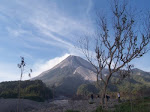
On Thursday 15th January 2009 Dieng Volcano was raised from level I (normal) to a level II alert (out of a maximum of IV) after two phreatic eruptions on 15th January. The eruptions occurred at Sibanteng Crater at 8:00 and 8:30 am. Volcanic material was ejected 50 m from the crater causing no fatalities since it is located away from the settled area. It was reported that there was no poisonous gas detected in the area. The phreatic eruption was initiated when the Sibanteng Crater collapsed causing blockage of the crater and a build-up of gas pressure. The material flowed down, blocking the Suci River threatening to flood the populated area below. It is reported that on 22 January the Suci River was still flowing but that the 40.000 m3 of material in the Sibanteng Crater present a threat to the villages of Pulosari, Ngandam and Tempuran in the event of heavy rain.
Dieng Volcano complex is located near Wonosobo, Central Java, Indonesia. For several centuries volcanic activity at Dieng has been dominated by phreatic eruptions, and geothermal activity (fumaroles, solfataras, mud pools, hot springs). The volcano is composed of two strato volcanoes (Butak Petarangan and Dieng) and many craters. Warm acidic lakes fill some of the craters. Volcanic cones at Dieng include the following - Bismo, Srojo, Binem, Pangonan, Merdodo, Pagerkandang, Nogosari, Petarangan, Telogo Dringo, Pakuwaja,Kendil, Kunir and Prambanan.
Dieng Volcano is noted for the release of carbon dioxide, which sometimes results in fatalities to residents as it happened on 20 February 1979 when 149 died after inhaling poisonous gas from the eruption of its Timbang Crater. Fumarole areas include Kawah (crater) Sikidang, Kawah Sigajah, Kawah Kumbang, Kawah Sibanteng, Kawah Upas,Telogo Terus, Kawah Pagerkandang, Kawah Sipandu, Kawah Siglagah and Kawah Sileri. Butak Petarangan is the second highest volcano located in the Dieng complex. It consists of a crater-lake named Telogo Dringo and Condrodimuko Fumarole Field. Sileri Crater which is the most active had its last phreatic eruption in July 2003.
The morphology of the area is mostly hilly, with gradients in the range of 10-40 degrees. It lies 1900-2000 meters above sea level. The lithology mostly consists of piroclastic deposits. The plastic soil is reddish brown in color and the grain size of the soil is silt-clay with thicknesses between 1-3 meters. The Sibanteng Crater landslide was triggered by the lithology, morphology and the water condition of the area. Heavy rain occurred during 3 days prior to the landslide. Based on observation, the poisonous gas concentration is still below the allowed limits.
Based on visual and data analysis, on Thursday 22th January 2009 at 4:00 pm, Dieng Volcano's status decreased from level II to level I (Normal). Howevere there is still potential for phreatic eruptions, and general awareness must take this into account, especially during heavy rains which could trigger more landslides.
Resource : Report from Geology Agency, Republic of Indonesia
Monday, February 2, 2009
Subscribe to:
Post Comments (Atom)


0 comments:
Post a Comment