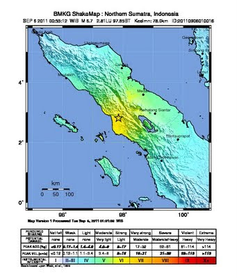
Magnitude 6.7 struck North Sumatra region on Tuesday, September 06, 2011 at 00:55 AM local time. The epicenter located 59 km northeast of Singkilbaru-Aceh, 75 km southeast of Kutacane-Aceh, 78 km southwest of Kabanjahe-North Sumatra, 100 km southwest of Medan, onshore at position 2.81°S, 97.85°E with a depth of 78 km.
As in Tuesday September 6, 2011, 3.15 AM, no fatalities reported yet. Power is out throughout the epicenter region. Even though the authorities ensure that no tsunami is going to occurs, panicked residents still fled to higher ground fearing giant waves.
Update: As in September 9, 2011, at least two fatalities were reported and numbers of building collapses.
Monday, September 5, 2011
Subscribe to:
Post Comments (Atom)


0 comments:
Post a Comment