As for info, the Center has set four levels increasing intensity of volcanic activity with level I for the lowest and level IV for the highest.
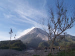
The 3,676-metre (12,060-ft) Semeru is one of the most active volcanoes on Java Island. Geographically, it’s located at the position of 8° 06’ 30’’ Latitude and 112° 55’ Longitude. Its highest point is called Mahameru (+ 3676 meter) which is the highest peak on Java. The last eruptions phase activity were observed at the volcano on 9,14, and 17 June 2011. Activity resumed at the end of December 2011. Between 29th December 2011 and 15th January 2012 there were eight explosions at Jonggring Seloko crater, sending ash up to 600 m high. The nearest major city to Semeru is Surabaya. The area is also popular with hikers and nearby Mount Bromo is a well known tourist site.
Hot-line Information: Geological Hazard andVolcanology center of Indonesia (Pusat Vulkanologi dan Mitigasi Bencana Geologi) phone number: +62-22-7272606
 Figure caption: Semeru mountain (the tallest volcano on the background) during its quiescence period with the Bromo-Tengger caldera at the foreground, at Bromo-Tengger-Semeru National Park. (Photo courtesy of: Gayatri Indah Marliyani, captured at 5.42AM, January 8, 2006)


1 comments:
wow this pics really very cool to see but its hard to imagine about it !!!! so its important for us be ready to face such natural disaster and safety training..........
Post a Comment