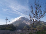
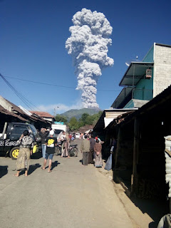
At 7:40am on May 11, 2018 an eruption occurred at Merapi
volcano. There are no sign of increasing seismic activity leading to the event
except a short increase of crater temperature at around 6:00am. Volcanic
earthquake that was lasted for around 5 minutes was felt all the way to the Yogyakarta
city as the eruption evolved. The eruption producing eruption column that
reached elevation of 5500 m through a single phreatic eruption. No subsequent
eruption were observed. The plume dispersed to the southeast, mm-thick ashes rained
area within 5 km from the summit. Thin layers of ashes reaches all the way to
Gadjah Mada University campus that are located 30 km to the south of the summit. No casualties being reported so far.
Link to the official monitoring status: Magma VSI-ESDM
Screenshot of the current status of the volcano (https://magma.vsi.esdm.go.id/vona/display.php?noticenumber=2018MER01)
Various photos captured by residents around the volcano (Disclaimer: these photos were collected through messages and updates posted in various social media and messages platform, some of the photo sources were unclear though the accuracy of locations and time of event has been validated).
Photo: Eruption column as observed from the northern slope of the mountain
Photo : Eruption column as observed from ~20km from the summit
Photo: View of the eruption plume seen from Cepogo traditional market in Boyolali
Photo : Eruption column as observed from Rawapening (35km to the north of the volcano)
Photo: View of the eruption plume seen from near Selo, Boyolali (north of Merapi)
The volcanic earthquake recorded from the BPPTK Merapi (source photo: BPPTK)
Ash dispersion pattern as observed by Himawari weather satellite (BMKG)
Video captured by hiker from hike post of Pasar Bubrah near summit area
Video captured by hiker from hike post of Pasar Bubrah near summit area


0 comments:
Post a Comment