Sunday, August 29, 2010

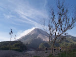
The un-expected Mount Sinabung eruption in North Sumatra, August 29, 2010

After a dormant period of 400 years, Mount Sinabung in North Sumatra erupts on Sunday, August 29, 2010 at 00.08pm. The ejected materials, seen as thick black smoke, consist of sands, small stones and sulfur gas reach as high as 1,500 meters (about 5,000 feet) and prompting the evacuation of at least 12.000 residents. One people reported died of breathing difficulties. The ash spread to a distance of 30 kilometers from the volcano. Evacuated resident are staying in government buildings, houses of worship and other evacuation centers in two nearby towns.

The volcano erupts after rumbling for several days. On August 29, 2010, the increasing activity manifest by white smoke and fumarola solfatara in the active crater. On the following day, Sunday at 00:08 pm, roaring sound heard from the summit area, remarking the main eruption stage. Center for Volcanology and Geological Hazard Mitigation (PVMBG) immediately raised the level alert into its highest level. This volcano previously classified as type B volcano, and after the eruption, PVMBG raised its type into type A.

The 2,460-meter Sinabung volcano located in District Tanah Karo, North Sumatra. The nearest major city is Medan. There is no flight disruption reported yet. The eruption was unpredictable, caused by lack of knowledge in terms of its eruptive patterns and general forms; the last activity recorded in this volcano was that in 1600.

A villager covers her nose and mouth from volcanic ash as Mount Sinabung spews smoke in the background in Karo, North Sumatera, Indonesia, Saturday, Aug. 28, 2010. (Image source: Associated Press)

Update: Second, more forceful eruption occurred early on Monday, August 30, 2010, forcing more than 20.000 people to remain in evacuation centers. The eruption occurred at 6.30 am create a column of smoke up to 2000 meter into the sky.

Mount Sinabung's second eruption on Monday, August 30, 2010 (Image source: The Jakarta Post)

Update: Third and even more forceful eruption occurred on Friday, September 3, 2010 around 4.38am. Covering nearby area with thick, black smoke. The sound and volcanic tremor felt by residents at 12 km away from the volcano.

Saturday, August 21, 2010

Magnitude 5.0 Yogyakarta Earthquake

A magnitude 5.0 struck Yogyakarta region on Saturday, August 21, 2010 at 06:41:38 PM local time. The epicenter located 6 km southwest of the damaging M 6.2 earthquake of May 26, 2006, onshore at position 8.034°S, 110.380°E (BMG). It is not clear if this events is related to 2006 events but by looking at alignment location of the epicenter, there is a big possibility that this earthquake occurred at the same fault system. The 2006 events caused more than 6.000 fatalities and a massive infrastructure destruction, leaves traumatic memories to the residents and causing panic reaction to this particular event. The shakes felt as a strong ground motion for about 5 seconds by the residents of Yogyakarta city, Bantul and Gunungkidul regency. No damaged and fatalities reported yet.

Location of this event related to 2006 event

Friday, March 12, 2010

Landslide In Cianjur, West Java

Another devastating landslide has occurred in West Java, following Ciwidey landslide that were happened 18 days before. The landslide occurred at Kampung Ciawi Tali, Cianjur, West Java Province on Thursday, 11 March 2010 at 6.30 pm. Seven people were confirmed dead and four others still buried under the debris and subject for search and rescue. At least 20 houses and school damaged and 100 people have been evacuated.

The prominent factors of landslide in Indonesia are lithology and morphology. Highly weathered material can be easily found in Indonesia. If it occurred on the steep morphology and water penetrate into the material, it will weaken the slope and increase the potential of mass movement as it cross the threshold. The increasing of precipitation rate during the late monsoon season should raise alert of the potential similar hazard near in the future. People living on unstable areas should be warned, prepared and trained to face it. A map of the susceptible-to-landslide area are available for most of Indonesian region (low resolution of the West Java image can be found here), that the government, from high to low level should be familiarize themselves with this map and socialized it to the people in the area. As published before in this website, applying a simple-low cost early warning system could be considered to reduce the causalities of landslide at high susceptible area, if relocation is not possible.

Friday, March 5, 2010

Magnitude 6.5 Earthquake, Southwest of Sumatra

A magnitude-6.5 earthquake struck the western shore of Indonesia's Sumatra island on Friday, March 05, 2010 at 11:06:57 PM. The epicenter located offshore at 4.032°S, 100.806°E at 22 km depth, about 165 km (100 miles) West of Bengkulu and 345 km (215 miles) South of Padang, Sumatra. This event causing panic but no casualties or damage yet reported. No tsunami potential being issued.

Epicenter location on Google Earth map

Moment tensor solution for this event can be found here.
Base map (topographic map scale 1:10.000) of Padang, Jambi, Bengkulu and surrounding area can be found here.

Thursday, February 25, 2010

Ciwidey-West Java landslide, 23 February 2010

A landslide buried a village in West Java early on Tuesday, 23 February 2010 around 7am. The site located in a tea plantation village of Ciwidey, about 90km south of Bandung, West Java and 150 km southeast of the capital, Jakarta. At least 45 people were killed, 21 people were confirmed died while 24 others still buried under the debris, houses occupied by 35 families working in the tea plantation buried by the landslide.

Weathered layers of lava, tuff and andesitic breccias made up the lithology of the area. Morphology of the area in general are hilly and steep. The area were included in the landslide hazard map of West Java province as high to medium risk zone. Heavy rain in the area during the week prior to landslide possibly was the main triggering factors beside the morphology and the lithology of the area.

The government investigates whether the land clearing practices by one of a tea plantation company at the 740-acre hillside were to blame, while the company owner blames the September 7.0 earthquake cause the cracks on the foothills that weakening the hillside.

Base Map and Initial Assessment

Picture showing the village before landslide (left) and after landslide (right). (Indonesian Geology Agency)

Villagers walk at a neighborhood hit by a landslide in Ciwidey district, West Java, Indonesia, Thursday, Feb. 25, 2010. Days of heavy rain prompted the landslide Tuesday afternoon at the mountainous tea plantation destroying scores of homes. (AP Photo/Irwin Fedriansyah)

Friday, February 19, 2010

Triangle of Life? How to Survive During an Earthquake

In recent years, an e-mail has been circulating which describes an alternative to the long-established "Drop, Cover, and Hold On" advice. The so-called "triangle of life" and some of the other actions recommended in the e-mail are potentially life threatening, and the credibility of the source of these recommendations has been broadly questioned (http://earthquakecountry.info/dropcoverholdon/).

Earthquakes occur without any warning and may be so violent that you cannot run or crawl; you therefore will most likely be knocked to the ground where you happen to be. Given the dynamics of earthquakes and their effects on structures, "Drop, Cover, and Hold On" is the single most useful instruction that you can follow to protect yourself in the majority of situations. It gives you the best overall chance of protecting yourself during an earthquake... even during quakes that cause furniture to move about rooms, and even in buildings that might ultimately collapse.

Studies of injuries and deaths caused by earthquakes over the last several decades indicate that you are much more likely to be injured by falling or flying objects (TVs, lamps, glass, bookcases, etc.) than to die in a collapsed building. The "Drop, Cover, and Hold On" position will protect you from most of these injuries. If there is no nearby space beneath a table or other furniture that can provide protection from these objects, ONLY then you should get next to furniture such as a sofa that won't tip over, cover your head, and hold on to the furniture and be ready to move with it as it shifts in the shaking. If there is no furniture, get down next to an interior wall if possible (exterior walls are more likely to collapse and have windows that may break) and cover your head and neck with your arms. If you are in bed, the best thing to do is to stay where you are and cover your head with a pillow. Studies of injuries in earthquakes show that people who moved from their beds would not have been injured if they had remained in bed.

In many seismically active parts of the U.S. and other countries, strict building codes reduce the potential of structure collapse. However, there is the possibility of structural failure in certain building types, especially unreinforced masonry, and in certain structures constructed before the latest building codes. Rescue professionals are trained to understand how these structures collapse in order to identify potential locations of survivors. The ONLY exception to the "Drop, Cover and Hold On" rule is if you are in a country with un-engineered construction, and if you are on the ground floor of an unreinforced mud-brick (adobe) building, with a heavy ceiling. In that case, you should try to move quickly outside to an open space. This cannot be recommended as a substitute for building earthquake-resistant structures in the first place!

If you do become trapped in a collapsed building, it will be important to immediately protect your airway against dust and debris by breathing through clothing or material (preferably a dust mask if one has been stored near their desk, bed, or other accessible location); check yourself for injuries and control any bleeding; find a source of light if possible; and make your location known to rescuers by tapping on a solid object with a rock or other instrument. Save your breath and energy. Delay yelling for help until you hears rescuers very nearby.

If a building does collapse, rescue teams will methodically search through the rubble for victims, using tools, search dogs, and electronic instruments that can detect the presence of live people. Survivors are usually found in spaces large enough for a human within the collapse debris, called "Survivable Void Space." It can be as large as an adult, or in the case of small children or infants, a very small space. The main goal of "Drop, Cover, and Hold On" is to protect you from falling and flying debris and other nonstructural hazards, and to increase the chance of your ending up in a Survivable Void Space if the building actually collapses.

The "triangle of life" advice is based on several wrong assumptions:
• buildings always collapse and crush all furniture inside (wrong);
• residents can always anticipate how their building might collapse and anticipate the location of survivable void spaces (wrong); and
• during strong shaking people can move to a desired location (wrong).

Experts agree that in the rare case that a building collapses, residents inside will not be able to anticipate the location of void spaces nor move to them during the strong shaking before the collapse. Some other recommendations in the "triangle of life" email are also based on wrong assumptions and very hazardous. For example, the recommendation to get out of your car during an earthquake and lay down next to it assumes that there is always an elevated freeway above you that will fall and crush your car. Of course there are very few elevated freeways, and laying next to your car is very dangerous because the car can move and crush you. A compilation of rebuttals from many organizations to these alternative recommendations, as well as news articles about the controversy, is online at www.earthquakecountry.info/dropcoverholdon.

In conclusion, the "Drop, Cover and Hold On" protocol, when performed correctly with an awareness of your surroundings, remains the most effective single piece of advice that you can follow when an earthquake occurs. More detailed information about what to do during an earthquake can be found here.